


Let's Hike: Bertha Peak
It was May in California and we were still in the midst of a ridiculous drought, but it happened to snow quite a lot in the mountains. We got some rain - two days worth - out by the coast, but the mountains got the good stuff. The white stuff. We anxiously waited for the week to end so we could head to the mountains. Saturday morning finally rolled around and we hit the highway. The winding road that leads up to Big Bear Lake was a cloudy, foggy mess. There were moments when we literally couldn't see much more than a few feet in front of our car.

The Subaru took it nice and slow and got up the mountains, through the mist, and safely delivered us to the trail of the day.
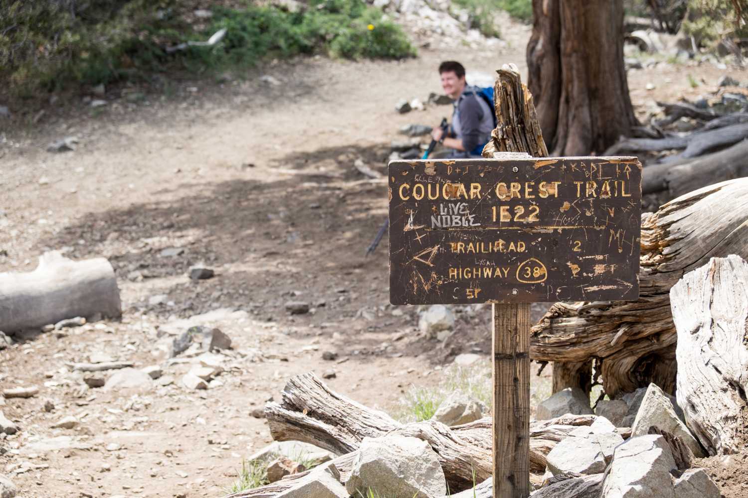
We stopped at the multi-trailed Big Bear Discovery Center to check on trail conditions and then headed 1.2 miles further up CA-38 to the Cougar Crest Trailhead.

This is an almost 8 mile out and back climb, with a little over 1,200 foot elevation gain. The hike starts out with a wide path that after a mile starts to narrow and steadily you'll start gaining elevation. For the first 3 miles, before you join the PCT, there are great views of Big Bear Lake if it is clear and a lot of large and fascinating trees along the trail.


After about 3 miles, Cougar Crest meets the Pacific Coast Trail. Continue on the PCT for less than 1/4 mile and you'll come to a fork in the path.

Veer right at the fork, someone made an awesome sign that is now quite faded but still visible, this leads up a steep fire road.
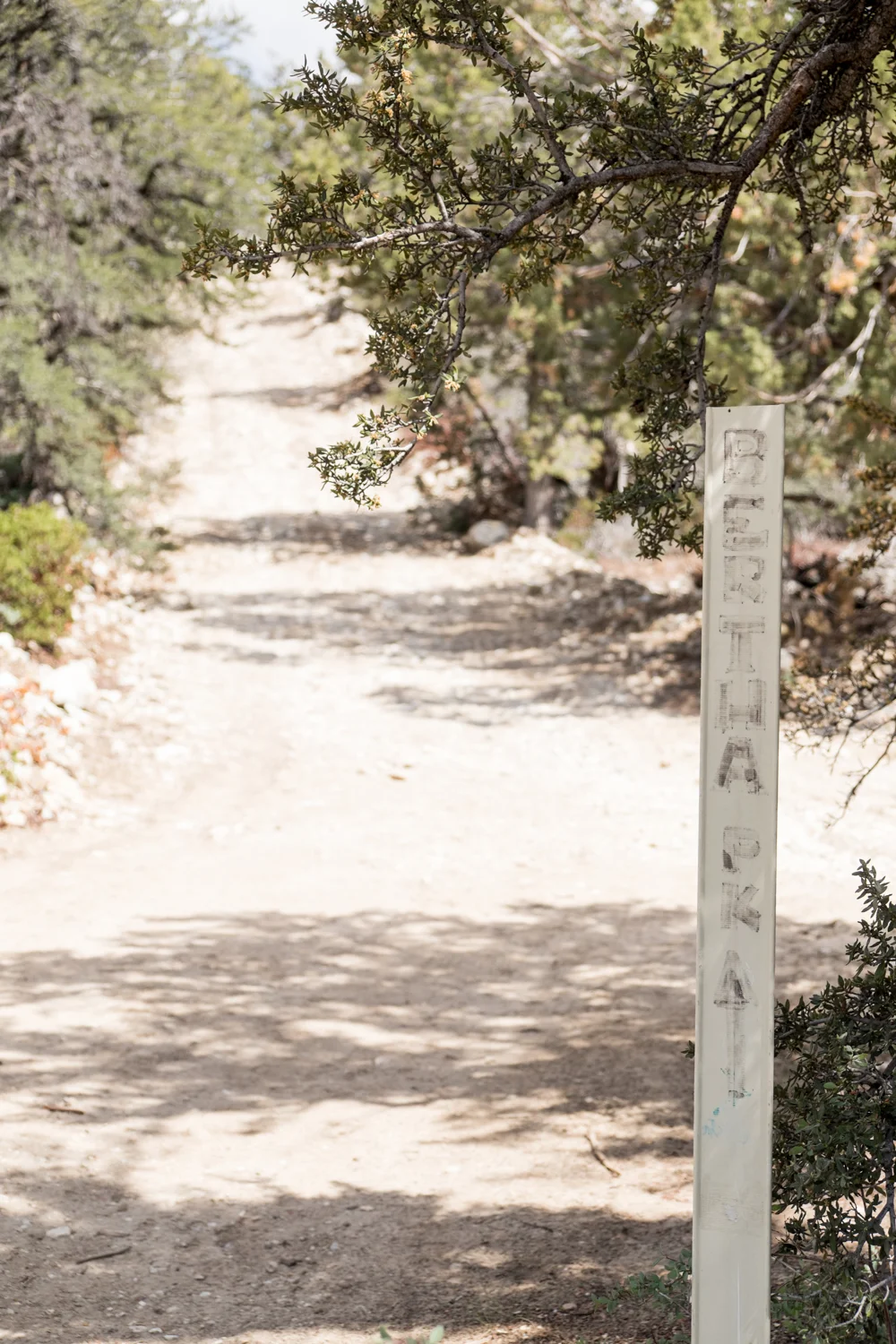


Take this rocky, steep 0.8 miles up to the top, you'lll run into radio towers and know that you'll be at the top of Bertha Peak. She sits 8,200 feet up in the air, and is a good workout. The views are worth it.
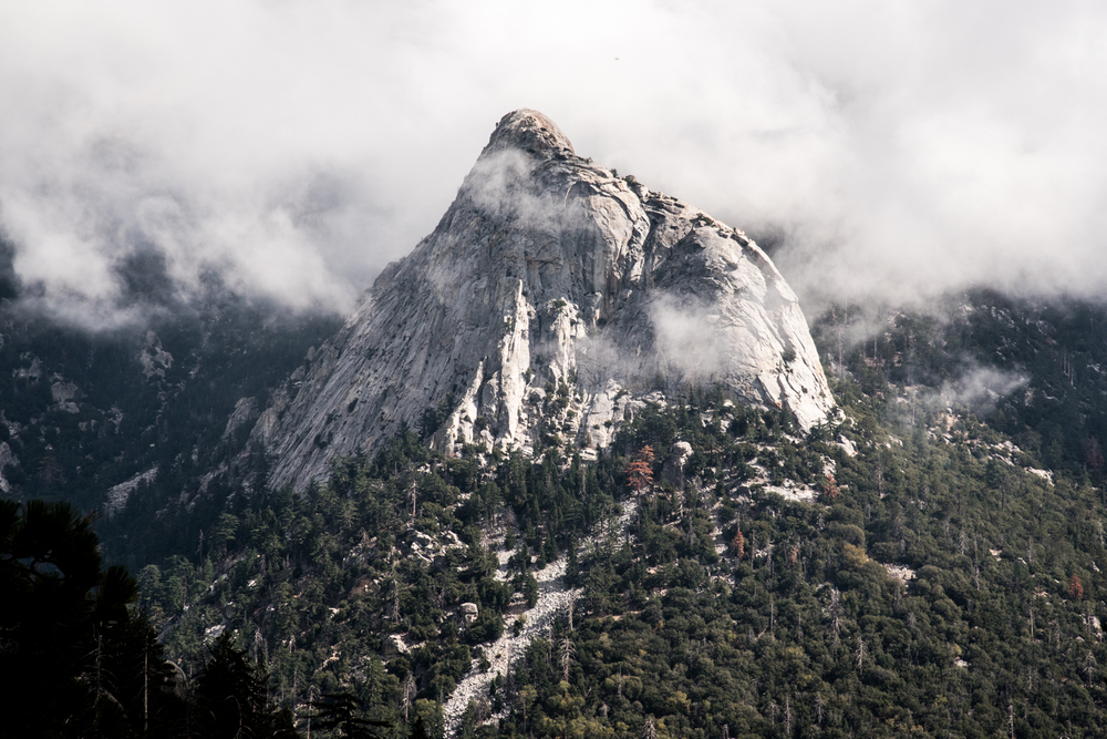
Neighboring mountains, a lake, and ski slopes... all surrounded in clouds and fog. The peak provides panoramic views of Big Bear Lake, the Antelope Valley, and the Mojave desert. This is a great day hike - again, slightly less than 8 miles, with an almost 1,300 foot gain. You'll grow thirsty and hungry along those 8 miles, so pack plenty of snacks and water. This trail was almost empty when we hiked it - only passing 4 other hikers the entire time. Since we arrived in the clouds, we didn't have much of a view, but as we hiked back down it definitely cleared up a bit for some blue skies.