


Point Reyes: Bear Valley to Meadow to Sky to Coast Loop
We have visited Point Reyes once in the past and we knew we’d make a return visit to hit the trails. Our first trip was hindered by an injury, so we didn’t get to explore much outside of where the car could go. This second trip was going to involve some trails and hiking! We planned ahead of time and did some research on what other hikers have enjoyed and decided to make a loop plan that would get us some variety of trail and scenery.
Point Reyes has some great trail maps available online, so we grabbed one and made some quick notes about what trails to follow. Upon arriving at the Bear Valley Visitor Center, we stopped to chat with a Ranger and get some insight on what we had chosen to hike. The Ranger let us know the trails were in good shape (some are often overgrown or washed out, so it’s good to check).
We went back to the car, grabbed our packs - with snacks, lots of water, and sunscreen - and headed out on the trail. The Bear Valley Trail leaves right from the parking lot, and heads straight into the woods. We passed several hikers here, and lots of berry bushes and beautiful greenery. Trails here can get quite overgrown with poison oak (or blocked by trees that fall) so it’s best to check in at the ranger station before hitting the trail. And always, explore responsibly!
Meadow trail was a winner, and we enjoyed the climb up that trail. It is a fairly steep hike at the beginning, but it stabilizes to a more gradual incline as you reach the meadow areas. We had an unfortunate turn of events on this trail. The meadow is full of beautiful growth, but also lots of bees.


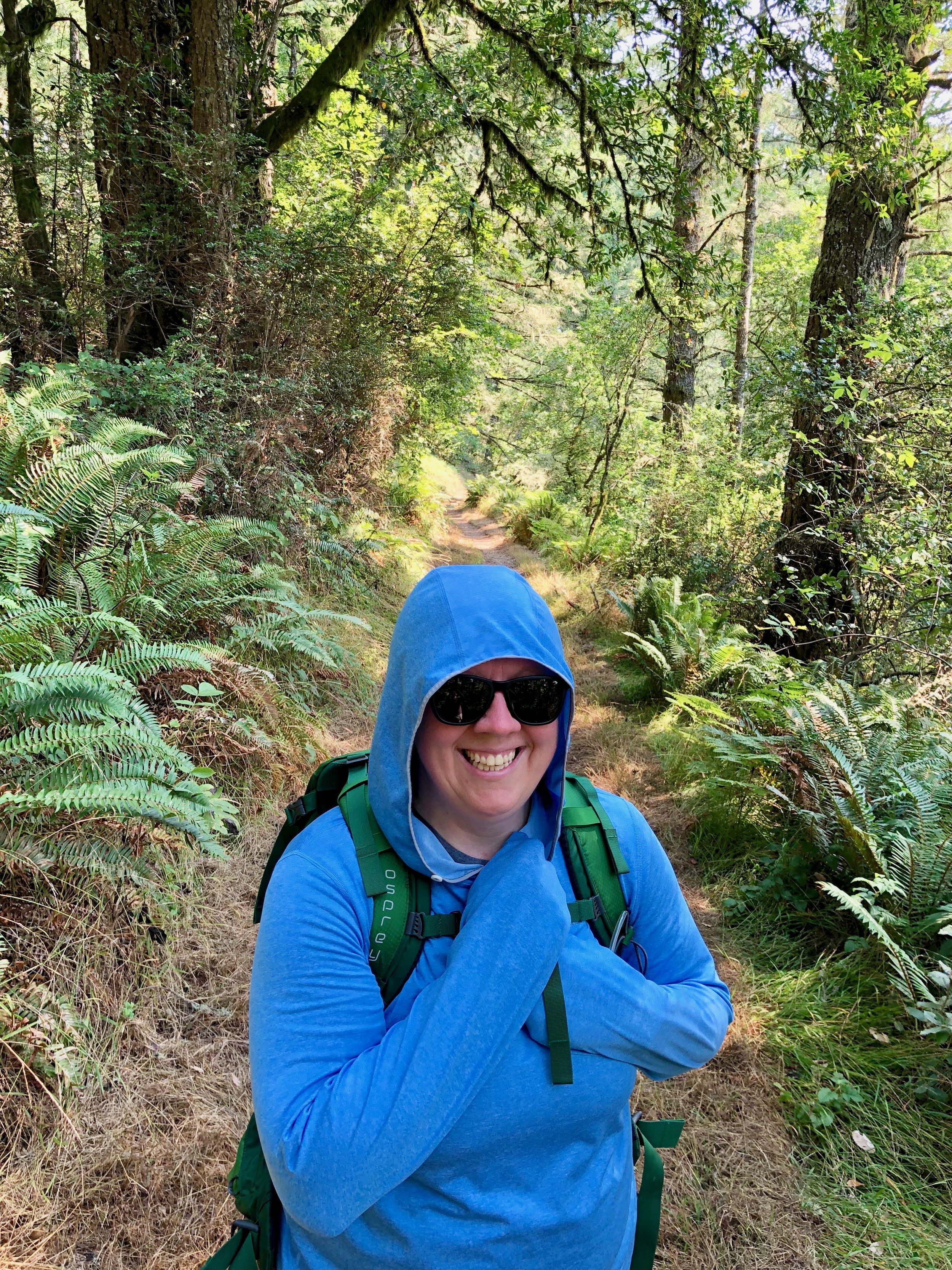
I (Andrea) am allergic to bees, so I carry Epipens and just try to co-exist with these bugs every where we go. At some point towards the end of Meadow, I had a collision with a bee. I don’t think he intended to sting me, but he did sting my finger, and I immediately knew I had a scary situation to deal with. The stinger came out almost instantly, which is why I think things turned out okay, but wow did that sting hurt. It seems like the bee literally just ran in to my finger, and I reacted almost instantly by removing my wedding ring, which also pulled the stinger out. While my finger almost instantly started to swell, Kim grabbed an Epipen and checked to see if we had cell signal (we did not). I did my best to not panic and control myself - but I was super scared!
We had no signal to call for help, and really hoped we wouldn’t need to. We found some shade and I sat down to stay calm for a few minutes. We had a sting relief wipe in our first aid kit, which helped a little. When it seemed like my breathing was going to remain okay, and my throat wasn’t closing, we decided to just try to finish the hike. We also thought Sky may have cell signal since it is a higher trail, and also more hikers, since it’s a little more popular. I really didn’t want to turn around and call it a day, so onward we went! Everything ended up being just fine, nothing more than a very sore hand for the day!

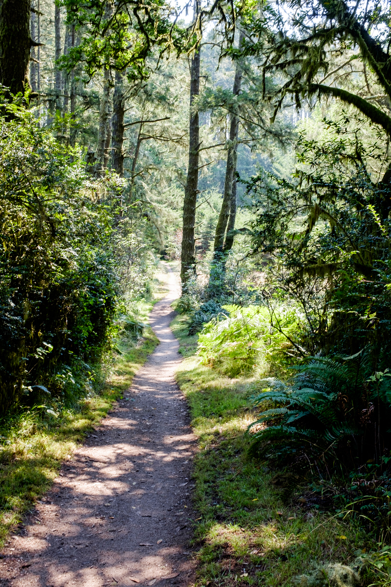

When Meadow hit Sky, the trail became a magical green rainforest. The trees are tall, the moss is thick and bright green, and the forest just seems so alive. Towards the end of Sky, the trail starts to zig zag a little, and so your feet are following a very narrow foot path. There was a lot of tall grass and tall shrubs along the trail, and we were startled a few times by snakes squiggling by right in front of us. We heard lots of little squiggles in the bushes, and more than once, just kind of jogged through this area. So many snakes!


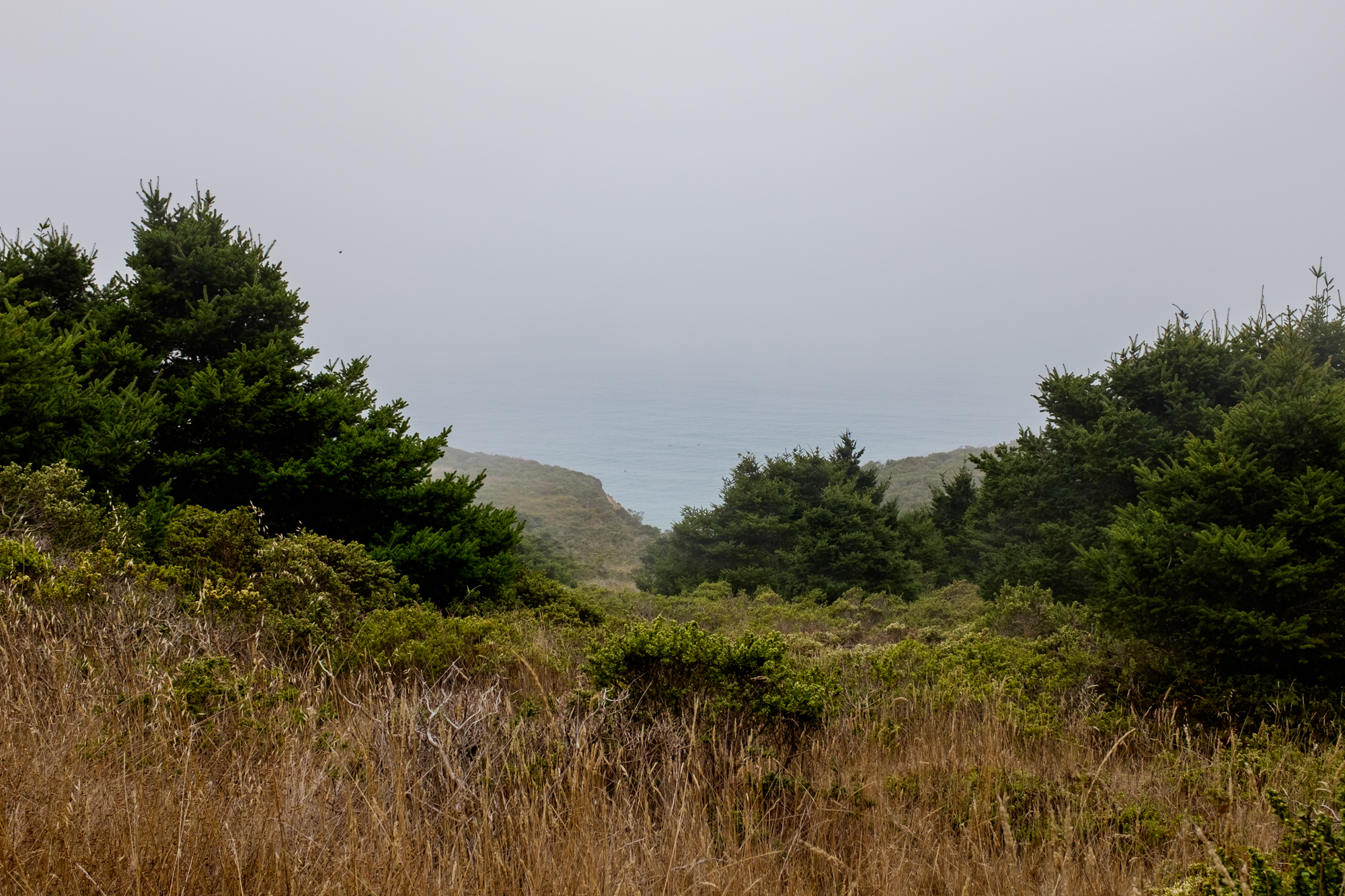
The 3.9 miles on Sky took us right out to the coast, with some great viewpoints through the greenery. The last half mile or so is actually on Coast Trail, as Sky dead ended. We were up above the coast, but we had plenty of fog and the sound of waves crashing to let us know we were right near the water. There are options to break off out here and get down to the beaches, but we just stopped and had some snacks and enjoyed the cool ocean breeze.


After a lunch break here, we turned back to Bear Valley Trail and just stayed straight ahead until we hit the parking lot. This trail widens just a bit off the coast and becomes a very smooth trail. We actually saw people with strollers on this part of the trail. The trail goes right along the edge of Coast Creek, so there are some great sound effects and lots of green growing along the trail. The overhang trees create a tunnel effect every so often. While it’s a heavily trafficked, “easy” trail, it really was beautiful and we enjoyed the water running alongside us. We came across one large tree that had fallen recently, and had fun climbing through a tunnel to stay on course.


A little over halfway from the coast to the parking lot, there is a small picnic area and a bathroom. There are some picnic tables and shade trees, but we had our eyes set on getting back to the car by this point in our hike. We had more snacks and an ice pack for the sore bee sting waiting for us!


Here are the specifics of our route:
Start at Bear Valley Visitor Center parking area
Bear Valley Trail: 0.8 mile
Meadow Trail: 1.6 miles (steepest part)
Sky Trail: 3.9 miles
Coast Trail: 0.5 mile
Bear Valley Trail: 4.0 miles
Total: 10.8 miles
After getting to the parking lot and resting our feet, we headed back to our AirBnB. The next morning, we were a bit undecided about what to do, but both wanted to go back to Point Reyes. Why not? We went back the second day and parked in the same parking lot and headed out on a second trail! This one, much shorter, much easier, and still pretty cool.
We did the Earthquake Trail which is a 0.6 mile paved loop. It takes hikers around some interpretive signs with info about the San Andreas Fault, the 1906 earthquake, and general info about the geology of the area. One spot lets you see the dramatic movement that the 1906 earthquake caused - a fence shifted 20 feet apart! This is a very short hike, but it is really great to learn more about the area!


We drove around a little more after that short hike. We enjoyed a break for lunch at a little spot on the outside of the park. We wandered around some of the big beaches. Drake’s Beach was our first beach stop - it’s a large beach with beautiful rocks and a visitor center. The next beach was Point Reyes Beach North, and we were treated to some huge waves crashing and even some surfers. We also stopped at the always crowded Cypress Tunnel and the historic KPH Maritime Radio Station, which was closed. We had the best experience of the day at our last stop. We drove up to the Tule Elk Reserve area and walked out to the beach. Up on a nearby hill, there were several elk making a lot of noise. On our drive back, we encountered a large herd of these big animals and they were making all kinds of noise in the fog. It was so cool to see, and ended our second day in Point Reyes on a great note!


We love the Point Reyes National Seashore area, and similar to our first visit, we left the second visit already planning for next time. The hiking here is great, and the area is just beautiful, and rarely very crowded. The hiking options include some hike out camping, which will be on the list for next time!
Have you been to Point Reyes? Tell us about if, if you have!


